Dear Readers,
I'm going out for vacations.....I will return on May 22nd.
Please, stay tuned for more news, reviews and photos....
Below you will find a nice article from Wired Magazine about the GPS Revolution.
See you soon....
Mavilonus
![]()
![]()
Inside the GPS revolution it's more than maps and driving directions: location-aware phones and apps now deliver the hidden information that lets users make connections and interact with the world in ways they never imagined. The future is here and it's in your pocket.

1 - Drive Fast, Avoid the Cops
Application: Trapster
Platforms: iPhone, BlackBerry
Price: FREE!
People like to go fast. Two-thirds of drivers frequently exceed the speed limit, according to a recent study, and we suspect the other third just filled out the survey too quickly. This means everyone can benefit from Trapster, a program that pulls together crowdsourced info about the location of police traps. Drivers report red-light cameras, speed cameras, or cops hiding in wait, which all get added to a map of law enforcement hot spots for the next lead-foot coming down the highway. You can even set your phone to warn you audibly when approaching the fuzz. Coast clear? Floor it.
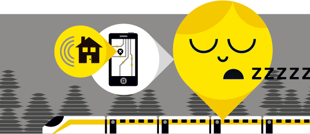
2 - Sleep Easy, We'll Wake You
Application: iNap
Platform: iPhone
Price: $1
There's nothing like the click-clack of train tracks to lull you to sleep. And there's nothing like the fear of missing your stop to jolt you awake every 15 seconds. You can avoid this seesaw with iNap, a travel alarm that keeps you from dozing past your destination on public transit. Just use the Google map embedded in the app to indicate where you'll be getting off, then hit the hay. As long as your iPhone can get a GPS signal (sorry, subway riders), the program will track your location and trigger an alarm a preset distance before your stop. Remember to wipe off the drool before disembarking.

3 - Play Tag, With Strangers
Application: JOYity
Platform: Android
Price: FREE!
Not all GPS programs are practical; some are just fun. Like JOYity, which includes three location-savvy games plus an interface to create your own. Here's how to play YouCatch, JOYity's digitally enhanced game of tag.
Target Log in and the app will determine your coordinates and briefly show you the location of the person you need to tag. Remember, once you start your game, someone else will be looking for you as well. Everyone's location will be displayed at regular, decreasing time intervals.
Tag Get within 80 feet of your subject, then press the trackball on your phone to execute the tag. Then go after your next victim. Every time you catch someone, you're assigned a new target. But keep moving, because someone out there is still looking for you. The last person standing wins.
4 - Call a Cab, the Easy Way
Application: Cab4Me
Platform: Android
Price: FREE!
Hailing a taxi in New York is a cinch. But say you're in Dallas on business, not sure where you are, and don't know the name of a local taxi company—catching a cab gets a wee bit tougher. Enter cab4me. The program displays your location on a map and pulls up a list of local cab companies. For now, you'll have to give the dispatcher your cross streets, but the app's makers hope to eventually let you complete the entire transaction automatically. Once the call is made, just stay in the same place and wait. Kind of like what you were doing before, just without the frantic hand-waving.
5 - Scan a Barcode, Find a Deal
Application: ShopSavvy
Platform: Android
Price: FREE!
It's the worst feeling: standing in the store, wondering if that thing you're about to buy is cheaper somewhere else. ShopSavvy makes sure impulse buyers always find the best deal. Scan a barcode with your phonecam and the app shows you how much the product costs online as well as at other stores nearby. You can even pull up reviews to make sure you're not skimping a little too much.
6 - See the World, Through Google's Eyes
Application: Google Earth
Platform: iPhone
Price: FREE!
The iPhone version of this popular app zooms in on your location, then lets you pan around to see the world through Google goggles. This includes satellite views of the streets and buildings in every direction as well as Wikipedia entries of interesting spots down the road and photos of nearby landmarks taken by users of Google's map-based picture database, Panoramio. Just don't expect to do any of it in a big hurry. Unlike the spry Google Earth on your computer, this version is maddeningly slow. Get it together, Google.
7 - Train Your Phone to Know Its Place
Application: Locale
Platform: Android
Price: FREE!
Turn off your phone's ringer and you won't interrupt today's matinee. Teach your phone to turn off its own ringer and you'll never accidentally rock the theater with your Van Halen ringtone again. Android's Locale lets you program your cell to auto-adjust its settings based on where you are. Through its map feature you can put a bubble around, say, the local Cineplex and tell your phone to switch to vibrate when you're there. You can also have your phone automatically Twitter your location, change your wallpaper, and disable Wi-Fi and GPS (to save battery life) for any preprogrammed area. Others may not know to thank you, but they won't kick the back of your seat, either.

8 - Look Up! Be a Stellar Student
Application: GoSkyWatch
Platform: iPhone
Price: $10
Sure, anybody can identify the Big Dipper and maybe even Orion. But what about Scorpius? Or Hercules? Or Triangulum Australe? This app pinpoints where you are, then checks the current date and time to figure out what stars are above you. To get the name of a given cluster, just point the back of your phone toward it and, thanks to the iPhone's internal accelerometer, that constellation and its moniker will appear onscreen. To find more, just tilt and swivel the phone to pan around the sky (or scroll around with your finger). Zoom in on a specific planet or star and the app will tell you how far away it is. Hint: really, really far.
9 - Dark Alley? Call for Help.
Application: SafetyNet
Platform: Android
Price: FREE!
Finally, a right way to venture to the wrong side of the tracks. Use SafetyNet's map to select bad neighborhoods. Then, if you end up in a sketchy area, your mobile will switch into watchdog mode. If trouble arises, all you have to do is shake the handset and your phone will set off an alarm, start sending your location to friends and family every 30 seconds via Google Talk, take a picture, turn on its speaker, and dial 911 (or another emergency number) . The app announces each of these steps out loud so a would-be assailant can hear what's happening and give up. At the very least, they won't want to steal a cell phone that's shrieking about calling the cops.

10 - Go Here When You Gotta Go
Application: SitOrSquat
Platforms: iPhone, BlackBerry
Price: FREE!
There are some unavoidable gross-outs in life: swim lessons in the kiddie end of the community pool, the bus during flu season, a filthy public restroom. The good news: You can at least limit your exposure to germ-infested toilets. Fire up this app to find public bathrooms in your vicinity, complete with user ratings. Facilities are shown in order of closest location. Once you spot a near-enough john with a decent-enough rating, the application connects to Google Maps directions so you can start the cross-legged shuffle. Sorry, still no avoiding those snotty teens sneezing on the crosstown.
Via Wired.com
![]()
![]()
Navigon No Longer Selling Personal GPSs in US
Navigon will no longer be selling PNDs (personal navigation devices) in the US. In a statement released today, the company explains, 'Due to the difficult economic environment and the aggressive pricing we have decided to withdraw from the PND business in North America for the time being. We are however not closing down our Chicago office which will continue to serve our automotive and mobile phone businesses in North America.' With the rise of the smartphone, I wonder how long it will be until we see some of the bigger GPS manufacturers follow suit.
(Via Gizmodo: GPS.)
![]()
![]()

Pioneer presents a new in dash entertainment system with GPS navigation called Pioneer AVIC-F310BT. Pioneer AVIC-F310BT has a sale price of € 799, - relatively cheap, but that does not mean that the system is equipped sparingly. According to Pioneer, the AVIC-F310BT is the entry model for consumers who are fed up with cigarette lighters and suction cups to make the device work. The double-DIN mounting system offers a big advantage that a stand alone GPS navigation system also has: it is removable - the screen that is; which is enough to steer away most thieves.
AVIC-F310BT is an all-in-one system. Radio, CD player, USB connection with the option to connect an iPod and the navigation system are all combined. Pioneer AVIC-F310BT is controlled via the touch screen and even handsfree for those who wish to call using the built-in Parrot Bluetooth car kit. The navigation system is equipped with the maps of at lease 44 European countries and also offer free TMC traffic updates. Although F310BT is equipped with an SD card reader, it can only be used for new maps for the device or to bring in new POIs for the system. Another nice feature with this latest Pioneer system is the adjustable lighting which makes AVIC-F310BT suitable for many cars. The LED colors of this system can match the interior of your vehicle.
Users can also use the free NavGate Feeds software from the manufacturer on their PC and use it to connect to the detachable screen we just mentioned. The software can also be used while driving, to monitor fuel consumption and carbon dioxide emissions. The manufacturer suggested retail price is set at € 799…
(Via NaviGadget.)
![]()
![]()

Mio Moov S501 was announced today, alongside Moov S401 which we just mentioned.
All the features are almost identical between the two units, except that Moov S501 has a bigger screen that measures 4.7″, and a bigger memory that holds about 12 million points of interests. The device will have North America maps, offer lane guidance, gas price search, a sample Wcities guide loaded, and Google Send to GPS.
Optional stuff are TMC receiver, more Wcities guide, and more maps.
(Via NaviGadget.)
![]()
![]()
Verizon Wireless Launches VZ Navigator Global Mobile services
Verizon Wireless launched a global version of its VZ Navigator service, providing travelers the ability to find locations and access turn-by-turn directions in North America and Western Europe, including Canada, Mexico, France, Germany, Italy, Norway, Spain, Sweden and the United Kingdom. VZ Navigator Global customers can choose either English or Spanish as the default language, and miles or kilometers to mark distances.

VZ Navigator Global is available for $19.99 per month and will be initially available on the BlackBerry Storm 9530 smartphone
(Via SlashPhone.)
![]()
![]()

Mio is coming up with a couple of new models for their Moov series. One of them is called Mio Moov S401.
Moov S401 will have a 4.3″ widescreen and carry about 4 million points of interests. It will feature the new Spirit interface Mio has been advertising lately.
A couple extra features are the ability to search for gas prices in your area, and the ability to use Google to send addresses to your unit. Though we’re not sure how it accomplishes these without the mention two way connectivity… Expect to pay about $130 for this unit.
(Via NaviGadget.)
![]()
![]()
Subscribe to:
Posts (Atom)
